
To get to Song-Kul from Bishkek, you drive 306 km by road: 200 km east and south to Kochkor, then 107 km up and over a high pass to the north shore of the lake. A routing engine puts the two legs at 3.0 hours and 2.3 hours of pure driving, with no stops. Most of the climb happens on the second leg, where the road rises from 1,809 m in Kochkor to 3,441 m before dropping to the lake at about 3,022 m.
Most travel pages sum this trip up in a line: a few hours to Kochkor, then a rough road to the lake. We wanted to see the whole road as one line: where it climbs, how high it goes and where the driving time goes. So we ran the route through open map and elevation data. The results are below.
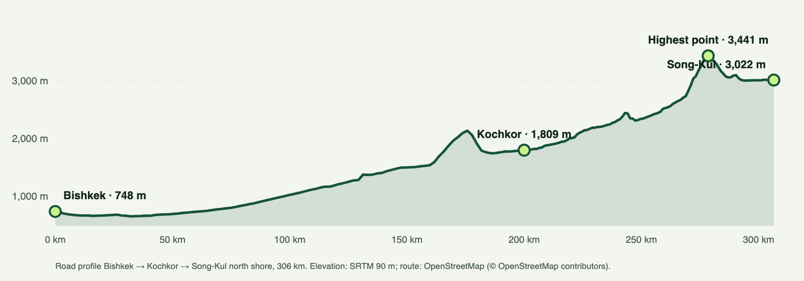 Road elevation profile from Bishkek via Kochkor to Song-Kul
Song-Kul from Bishkek at a glance
The short version: Song-Kul is a two-leg drive, and Kochkor sits between the legs. The first leg is long and climbs gradually. The second is shorter and climbs hard. All times below are routing-engine estimates without stops, so treat them as the floor, not a plan.
| Route | Road distance | Drive time (engine, no stops) | Start altitude | End altitude | Highest point on the road |
|---|---|---|---|---|---|
| Bishkek → Kochkor | 200 km | 3.0 h | 748 m | 1,809 m | 2,146 m (km 176) |
| Kochkor → Song-Kul north shore | 107 km | 2.3 h | 1,809 m | 3,022 m | 3,441 m (km 78) |
| Kochkor → Kyzart | 80 km | 1.4 h | 1,809 m | 2,098 m | 2,652 m (km 55) |
| Kochkor → Naryn | 120 km | 1.8 h | 1,809 m | 2,048 m | 3,021 m (km 54) |
| Bishkek → Karakol | 405 km | 6.5 h | 748 m | 1,749 m | 1,752 m (km 298) |
Three things stand out in this table.
- The whole trip is 306 km. The leg distances are rounded separately, which is why 200 km and 107 km don't add up to the total exactly.
- The highest point is near the end. The road tops out at 3,441 m at km 78 out of Kochkor, about 28 km before the lake.
- Song-Kul is not on the Issyk-Kul road. Bishkek to Karakol is 405 km and 6.5 hours of engine time, and it never climbs above 1,752 m. The Song-Kul route turns south towards Kochkor instead of following the lake shore east.
The road profile
Picture the elevation profile above as three parts.
From Bishkek at 748 m, the first leg gains about a thousand metres over 200 km. Its highest point, 2,146 m, comes at km 176, shortly before Kochkor, and the road then comes down to Kochkor at 1,809 m.
From Kochkor the road rises from 1,809 m to 3,441 m in 78 km. That's the real climb of the trip, and it all sits on the shorter leg.
After the high point the road drops for about 28 km to the north shore at about 3,022 m. So you arrive at the lake lower than the top of the pass, but still very high.
The high point in our data matches the published height of the pass: the road crosses the Kalmak-Ashuu pass, about 3,400 m. Our elevation model gives 3,441 m for the highest point on the road itself.
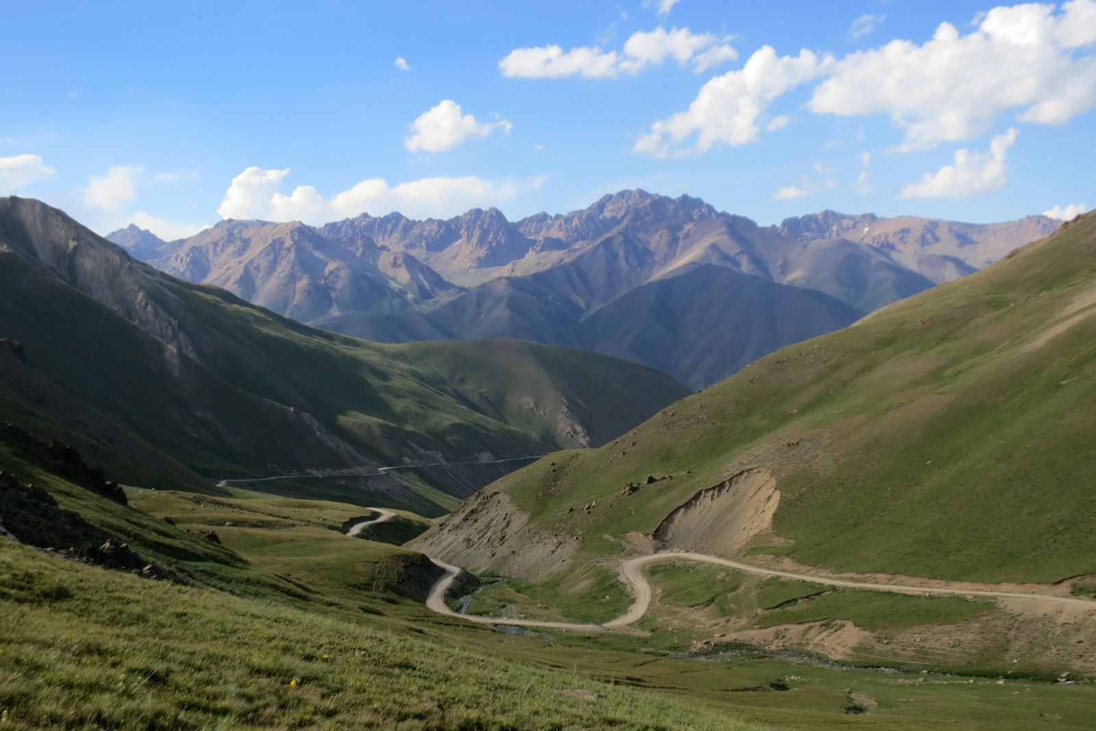 Photo: ThomasG · CC BY-SA 3.0Road up to Kalmak-Ashuu pass (towards Song-Kul)
Leg by leg
Bishkek → Kochkor: 200 km, 3.0 h without stops
This is the long, easy leg. The road is paved. It heads east out of Bishkek, through the Boom gorge towards Balykchy at the western end of Issyk-Kul, then turns south to Kochkor. The altitude change is moderate: from 748 m to 1,809 m, with a highest point of 2,146 m.
If you're going to Karakol instead, you leave this route near Balykchy and carry on along the lake. For Song-Kul you turn south.
Kochkor → the pass: the long climb
The engine time for the full Kochkor → Song-Kul leg is 2.3 hours, but this is the part of the trip where that number means least. A routing engine assumes a steady speed. It knows nothing about mountain gravel, livestock on the road, weather on the pass or photo stops on the way up.
We don't give a "real" drive time of our own here, because it changes with the vehicle, the driver, the weather and the day. What we can say is that the engine time is the minimum, and your actual time will be longer.
The pass → the lake shore
The last stretch is the descent to the shore. The Song-Kul guide covers what's at the lake itself: the yurt camps, what a night there is like and what to expect from the shore.
Where to stop
Kochkor is the natural stop. It comes after the long paved leg and right before the climb, so it splits the trip in a sensible place. You've done the easy 200 km, and the 107 km climb to the lake is still ahead.
There are two ways to use it:
- A lunch stop. Drive from Bishkek in the morning, eat in Kochkor, and do the climb in the afternoon. You reach the lake the same day.
- An overnight. Sleep in Kochkor at 1,809 m and drive over the pass the next morning. That turns one long day into two short ones and splits the height gain across two days as well.
Ilgiz lives in Kochkor and runs Guest House Mira there, listed on Booking.com and Tripadvisor. If you want to break the trip with a night in town, Ilgiz's guesthouse in Kochkor is one option.
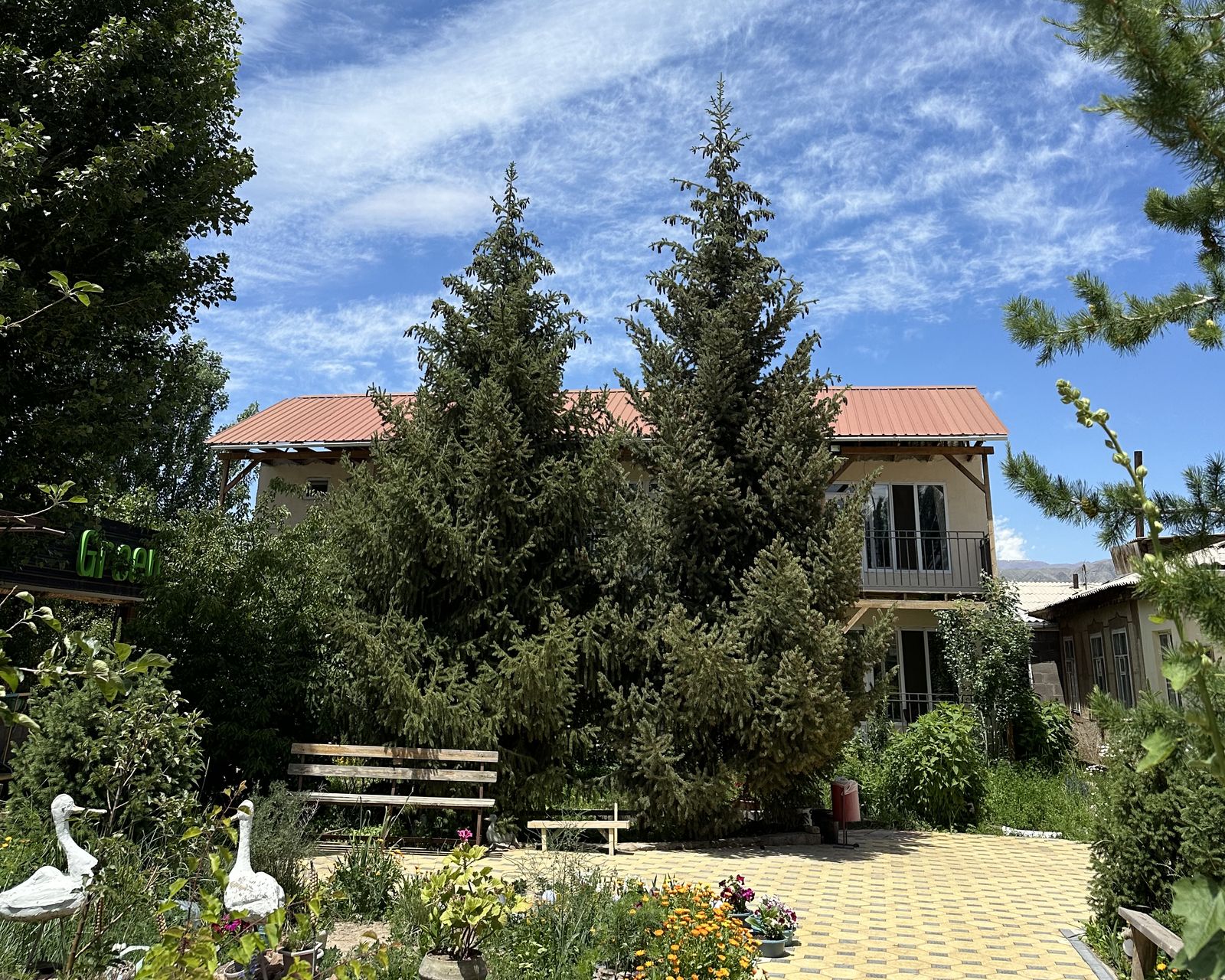 Ilgiz's guesthouse in Kochkor, with a garden courtyard
Kochkor is also the junction for the rest of Naryn region. The road south to Naryn is 120 km and 1.8 hours of engine time, and it crosses a pass at about 3,021 m (the Dolon pass). That's the road you take for our Kel-Suu trip, which starts in Naryn.
Jeep or horse
There are two ways up to Song-Kul on our trips, and they use the road very differently.
By jeep, you go over the pass on the road. The Song-Kul jeep tour starts in Bishkek and follows the road in the table: Bishkek → Kochkor → over the pass → down to the lake. It suits you if you're starting from Bishkek and want the whole trip handled from the city, including both yurt nights at the lake.
On horseback, you don't ride the road over the pass. The Song-Kul horse trek starts in Kochkor. From there it's a drive of 80 km and 1.4 hours (engine time) to Kyzart, where the riding starts. That drive tops out at 2,652 m, which is the Kyzart road pass; the published height of the Kyzart pass is 2,664 m. The riding route from Kyzart to the lake is a separate trail, and the numbers in this article don't describe it.
A simple rule for choosing:
- Starting in Bishkek, with no plans in Kochkor? Take the jeep. The tour starts where you are.
- Already in Kochkor, or happy to get there first? The horse trek starts in Kochkor and includes horses, a guide, two nights in yurts with dinner and breakfast, and transfers both ways.
- Want to reach the lake over the mountains rather than by road? Take the horse trek: you ride from Kyzart to the lake, and the trek includes the transfer back to Kochkor.
Altitude on the way up
The numbers here are what make Song-Kul different from most day drives. In one day by road you go from 748 m in Bishkek to 1,809 m in Kochkor, then up to a 3,441 m high point, and you sleep at about 3,022 m by the lake.
We're not doctors, and we don't give medical advice. Some practical points from the profile:
- The big gain is on the second leg. If you stop in Kochkor overnight, you split it from the first.
- Plan a slow first evening at the lake. Walk, eat, drink water, and save the long hike for the next day.
- Know the symptoms before you go. The NHS page on altitude sickness explains what to look out for and what to do. If you have a health condition, ask your doctor before you travel to this height.
When the road makes sense
Treat the road to Song-Kul as a summer road. The lake sits at about 3,022 m and the road goes higher still, so cold and snow reach it much earlier in the autumn than they reach Bishkek or Kochkor.
We don't publish road-opening or road-closing dates. They change from year to year and we have no reliable data for them. For the lake itself, our Song-Kul weather by week page shows when nights start to freeze. If your dates fall at the edges of the season, ask us about the road when you write.
How we calculated this
The distances and drive times come from OSRM, an open-source routing engine, running on OpenStreetMap road data. For each route we asked for the fastest road the engine could find. The drive times assume no stops at all and steady driving, which is why we call them engine times.
The altitudes come from SRTM elevation data via OpenTopoData. We sampled the elevation along each route to find the start, the end and the highest point, with the kilometre where it falls. We ran the numbers on 22 September 2026.
Two limits to keep in mind:
- SRTM is a coarse model. It can read a little high or low at a sharp pass. On the Kyzart road it gives 2,652 m where the published height is 2,664 m.
- OpenStreetMap is edited by volunteers. The engine follows the roads on the map. If a road on the ground differs from the map, the distance and time will differ too.
For background on the lake itself, see the Song-Köl article on Wikipedia.
If you'd rather leave the driving to us, the Song-Kul jeep tour covers this whole road from Bishkek over three days with two yurt nights by the shore. For a group of four it costs $475 each.
Song-Kul Lake 3-Day Jeep Tour
Published price, a named guide and a reply within 24 hours. From $475 per person, group of 4.
See the tripFAQ
How far is Song-Kul from Bishkek?
How high is the pass on the way to Song-Kul?
Is Kochkor on the way to Song-Kul?
How long is the drive from Kochkor to Song-Kul?
Sources and further reading
- OSRM routing engine on OpenStreetMap data (© OpenStreetMap contributors)
- OpenStreetMap copyright and licence
- SRTM 90 m elevation data via OpenTopoData
- Song-Köl — Wikipedia
- Kyzart (pass) — Wikipedia
- Altitude sickness — NHS
Last updated: October 2026. Facts are checked against the sources above; prices are the ones published on our tour pages.